 vesseltracker.com
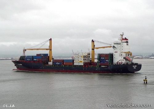
Vessel MSC EMILIE IMO: 9334832, MMSI: 636020695 Container Ship
UTC, 36.98283, 5.18511, course: 293, speed: 0.1
UTC, 36.98210, 5.16751, course: 330, speed: 0.5
2026-02-22 13:51:51 UTC, 36.98360, 5.15355, course: 319, speed: 0.4
Live AIS position:
UTC. 14 nm N of Bejaia),
updated 2026-02-22 13:51:51 UTC.
Find the position of the vessel MSC EMILIE on the map. The latter are known coordinates and path.
marine traffic ship tracker show on live map
The current position of vessel MSC EMILIE is 36.98360 lat / 5.15355 lng. Updated: 2026-02-22 13:51:51 UTCCurrently sailing under the flag of Liberia
MSC EMILIE built in 2006 year
Deadweight:
23685 tDetails:
Last coordinates of the vessel:
UTC, 36.98729, 5.18900, course: 292, speed: 0.4UTC, 36.98283, 5.18511, course: 293, speed: 0.1
UTC, 36.98210, 5.16751, course: 330, speed: 0.5
2026-02-22 13:51:51 UTC, 36.98360, 5.15355, course: 319, speed: 0.4